Book accommodation
Accommodation
Book accommodation
Accommodation
 Ski report
Ski report
Ski report
 What's on
Event
What's on
Event
 Webcam
Webcam
Webcam
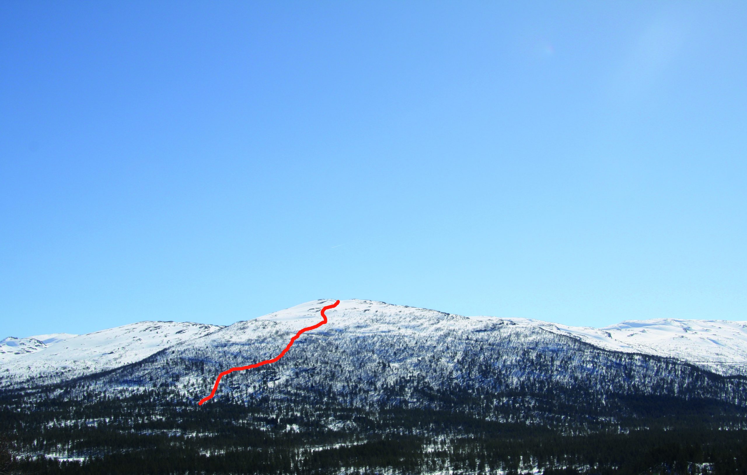
Randonee skiing to Glidbjørgnuten
Vestre Glidbjørgsnuten is located between Bykle and Hovden, east of the main road RV9. Although not that spectacular from a distance, the descent has many fun surprises and some very fine stretches. The challenging part is finding the straight lines through the forest. In some sections you have to make quick turns, and good skiing technique is therefore required.
When you are ready to climb the mountain, we advise you to follow the local road for a short distance after the barrier until you see an opening in the forest. Try to find the most open terrain and imagine that you will follow this track during the descent.
Vestre Glidbjørgsnuten is a good option in rough weather as most of the track goes through forest. However, the 1201-metre summit is exposed to wind and weather. Regarding avalanche risk, the vegetation makes the terrain relatively safe, and after a heavy snowfall you may enjoy good powder skiing.
WGS84
Start: 59.421483, 7.41869
Top: 59.420151, 7.449245
Parking: No official parking. Pay attention to other traffic.
Duration: 3 hours
Vertical drop: 520 m.
Orientation: west
FIND THE PERFECT LINE
Think safety when choosing a line down the mountain.
Our suggestions are just recommendations. Read the terrain
carefully, and consider the current snow and weather conditions.
You are responsible for your own safety.