Book accommodation
Accommodation
Book accommodation
Accommodation
 Ski report
Ski report
Ski report
 What's on
Event
What's on
Event
 Webcam
Webcam
Webcam
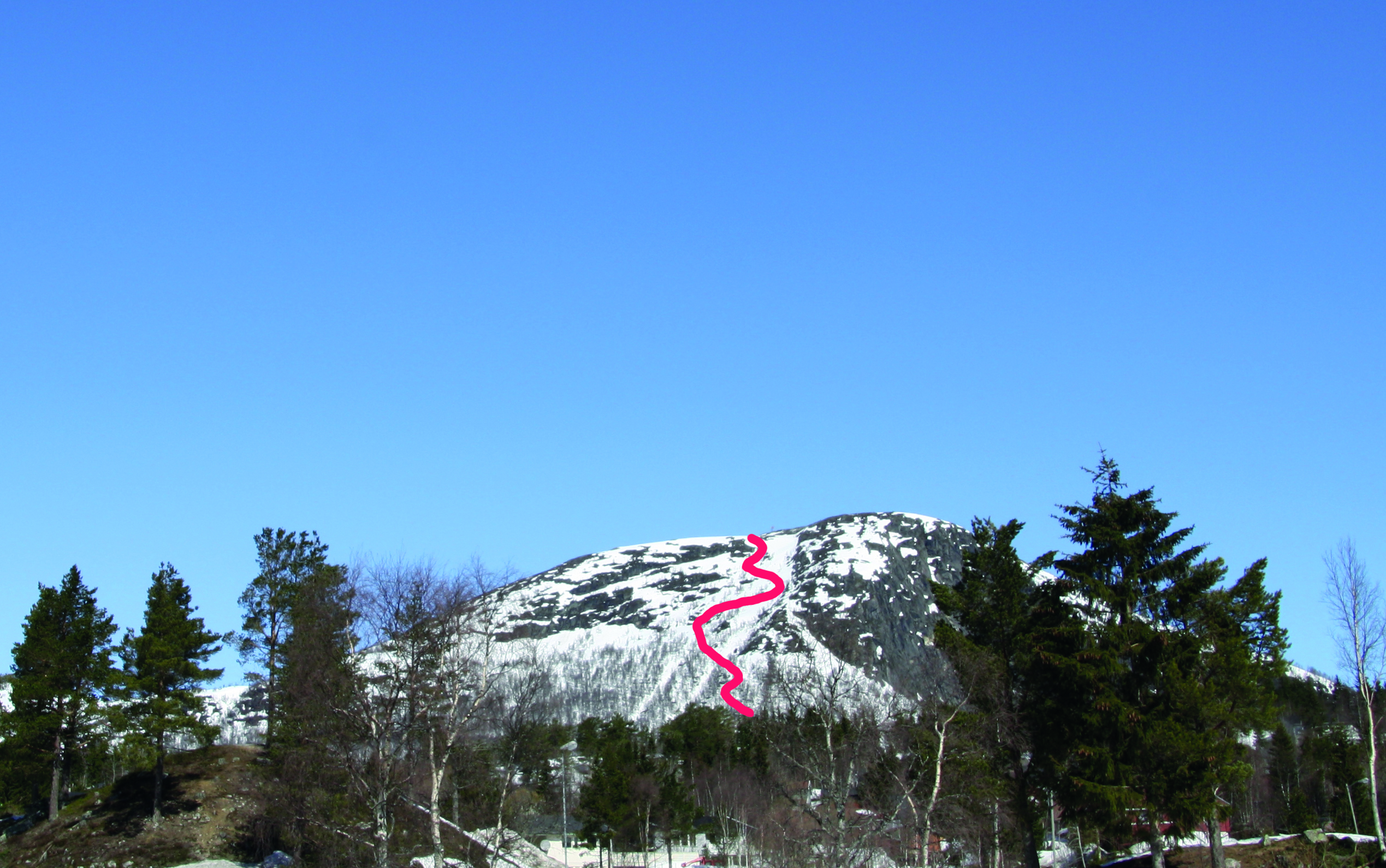
Randonee skiing to Vråstøylsfjellet
Vråstøylsfjellet is located close to central Bykle and is one of the steepest alternatives in this area. The mountain is easily accessible from the main road RV9. The descent is through couloirs in the mid-section of the rock wall, and large amounts of snow may build up here during heavy snowfalls. Only recommended for experienced skiers who are able to make short and quick turns.
If you come from the north, the ascent starts where the old road diverts to Bykle. There is a small parking spot by the road, but we advise you to park at the Bykle Community House. From the road, take a diagonal route up the mountainside, and finally you walk straight up the steep couloirs that you shall later descend. Crampons might be useful during the ascent. Or you may approach the mountain from the west, with the floodlit cross-country trail as entry point.
The summit at Vråstøylsfjellet is exposed to wind and weather, but the couloirs are fairly well sheltered. They face to the south, and there is consequently little risk of snowdrift build-up. However, you may encounter this if you move towards the eastern side of the mountain. Please note that avalanches may develop in the couloirs due to the steepness of the mountain.
WGS84
Start: 59.361567, 7.360582
Top: 59.375654, 7.358844
Parking: Bykle Community House, 600 metres from the entry point.
Duration: 2 hours
Vertical drop: 520 m.
Orientation: South
FIND THE PERFECT LINE
Think safety when choosing a line down the mountain. Our suggestions are just recommendations. Read the terrain carefully, and consider the current snow and weather conditions. You are responsible for your own safety.